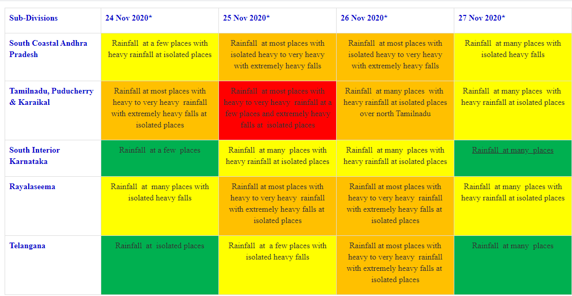
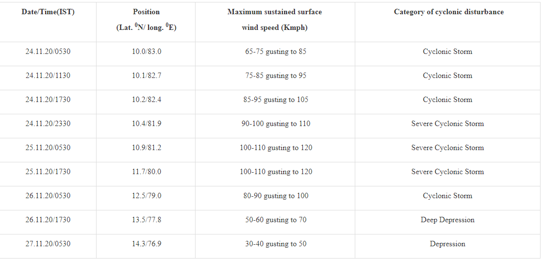
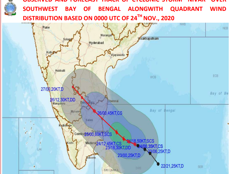
Deep Depression intensifies into a Cyclonic Storm “NIVAR” over southwest Bay of Bengal
Tidal wave of about 1m height above the astronomical tide is very likely to inundate the low lying areas of north coastal districts of Tamilnadu & Puducherry near the place of landfall.
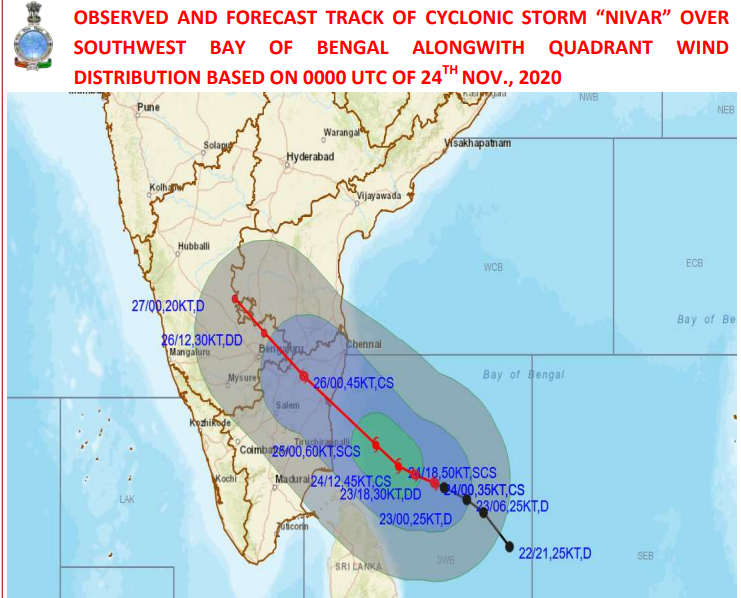
New Delhi, Nov 24: The Deep Depression over southwest Bay of Bengal moved west-northwestwards with a speed of 05 kmph during past 06 hours, intensified into a Cyclonic Strom “NIVAR” and lay centred at 0530 hrs IST of 24th November, 2020 over southwest Bay of Bengal near about 410 km east-southeast of Puducherry and 450 km southeast of Chennai.
It is very likely to intensify further into a severe cyclonic storm during next 24 hours. It is very likely to move west-northwestwards for next 12 hours and then northwestwards, according to the Cyclone Warning Division/ National Weather Forecasting Centre/Regional Meteorological Centre, New Delhi of the India Meteorological Department (IMD).
It is very likely to cross Tamil Nadu and Puducherry coasts between Karaikal and Mamallapuram around Puducherry during 25th November 2020 evening as a severe cyclonic storm with a wind speed of 100-110 kmph gusting to 120 kmph.