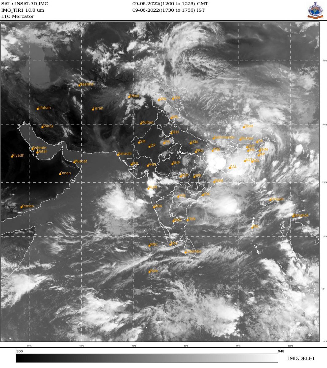
Coastal weather forecast: May 18

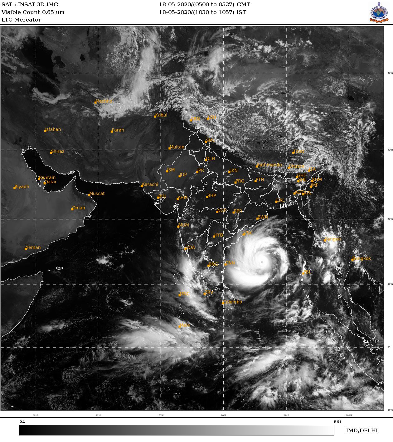 |
| Pic: IMD |
Fisheries Forecast:
VERY SEVERE CYCLONIC STORM” OVER BAY OF BENGAL
The Extremely Severe Cyclonic Storm ‘AMPHAN’ (pronounced as UM-PUN) over central parts of South Bay of Bengal and adjoining central Bay of Bengal moved nearly northwards with a speed of 13 kmph during past 06 hours and lay centred at 0530 hrs IST of today, the 18 th May, 2020
over west-central and adjoining central parts of South Bay of Bengal near latitude 13.2°N and longitude 86.3°E, about 790 km nearly south of Paradip (Odisha), 940 km south-southwest of Digha (West Bengal) and 1060 km south-southwest of Khepupara (Bangladesh). It is very likely to intensify further into a Super Cyclonic Storm during next 12 hours. It is very likely to move northnortheastwards across northwest Bay of Bengal and cross West Bengal – Bangladesh coasts between Digha (West Bengal) and Hatiya Islands (Bangladesh) during the Afternoon / Evening of 20 th
May 2020 as a Very Severe Cyclonic Storm with maximum sustained wind speed of 155-165 kmph gusting to 185 kmph.
WARNING:
Day 1(18-05-2020): Gale wind speed reaching 125-135 kmph gusting to 150 kmph likely over southern parts of central Bay of
Bengal by 18th morning; Squally wind speed reaching 45-55 kmph gusting to 65 kmph is likely along & off south Odisha
coast. Sea condition will be very high over south & adjoining central Bay of Bengal. It will become phenomenal over
southern parts of central Bay of Bengal.
Day 2(19-05-2020): Gale wind speed reaching 160-170 kmph gusting to 190 kmph likely to prevail over northern parts of
central Bay of Bengal and adjoining north Bay of Bengal and squally wind speed reaching 45-55 kmph gusting to 65 kmph
along & off north Odisha & West Bengal coast. Sea condition will be phenomenal over central Bay of Bengal & adjoining
North Bay of Bengal.
Weather Condition in Canara :
Dakshina Kannada :
May 18 (10 am) to May 19 (8.30 am): Moderate to Heavy rainfall very likely at wide spread areas. Warning: Thundershowers with gusty wind and heavy rainfall.
May 19 (10 am) to May 20 (8.30 am): Light to Moderate rainfall very likely at many places. Warning: Thundershowers.
Udupi:
May 18 (10 am) to May 19 (8.30 am): Moderate to Heavy rainfall very likely at wide spread areas. Warning: Thundershowers with gusty wind and heavy rainfall.
May 19 (10 am) to May 20 (8.30 am): Light to Moderate rainfall very likely at many places. Warning: Thundershowers.
Uttara Kannada:
May 18 (10 am) to May 19 (8.30 am): Moderate to Heavy rainfall very likely at wide spread areas. Warning: Thundershowers with gusty wind and heavy rainfall.
May 19 (10 am) to May 20 (8.30 am): Light to Moderate rainfall very likely at many places. Warning: Thundershowers.
Thunderstorm with lightning accompanied by gusty winds speed reaching 30-40 kmph likely at isolated places over Coastal Karnataka on May 18th. Thunderstorm with lightning likely at isolated places over Coastal Karnataka on May 19 and 22.
Data based on IMD website